GOOGLE STREET VIEW OUR LOCAL ATTRACTIONS
Useful Maps
- Fairbrother Loop Self Guided Walk
- Whakatane Walking tracks
- Whakatane Heritage trail
- Whakatane parks
- Whakatane Urban Cycle Trails
Attractions & Activities
- Whakatane Bike Parks
- Family Activities in Whakatane
- River Edge Park Miniature Railway
- Playgrounds & Skate Parks
- The Berry Trail
Events

Whakatane is host to many natural and man made attractions that has made our town an activity destination in its own right. The town is fortunate enough to have close access to the Ocean, River and Lakes and it is in these areas that we believe you will discover Whakatane.
Whether you're young or old, love adventure or prefer the sights, Whakatane has an attraction waiting for you.
Beaches, Bushwalks, Islands, Historical Sites, SK8 Parks and Playgrounds plus much more.
Scenic Attractions
 Kohi Point
Location: See Walks Map for Kohi Point locations & car parks
Kohi Point walkway winds its way around the steep terrain that forms the headlands between Ohope Beach and Whakatane. A 2-hour walk from Ohope the track first finds magnificent vistas of Ohope Beach and then discovers Otarawairere Bay. Average fitness is required as there are some extended inclines.
The track has access to the site of Tois Pa or Kapu Te Rangi. A Historical reserve steeped in Maori Tradition.
The walk forms part of a 7-hour loop walk called The Nga Tapuwae O Toi Walkway or the Footsteps of Toi. This track, in it entirety, takes in Whakatane, the Mokorua Bird Walk and the Ohope Scenic Reserve.
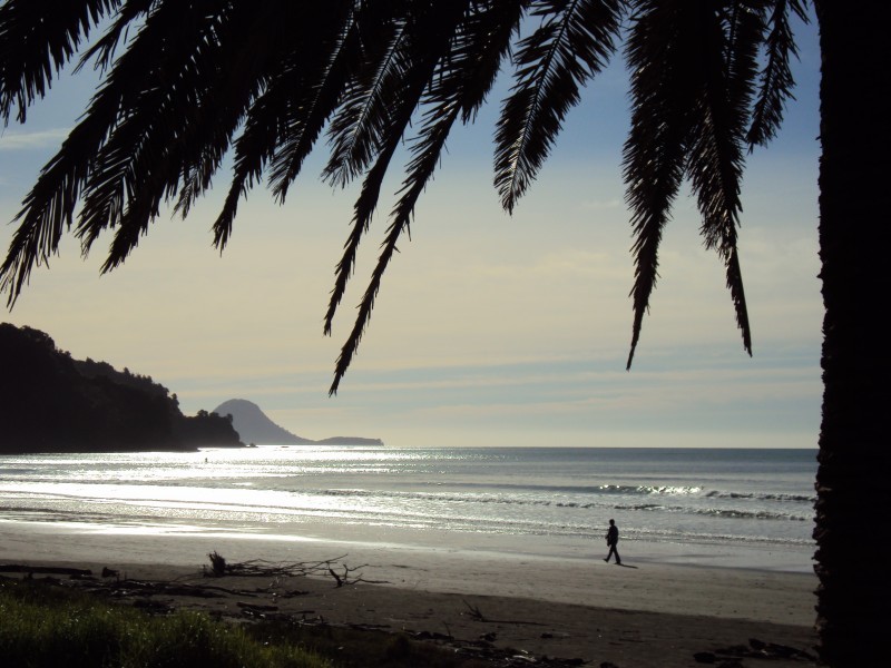
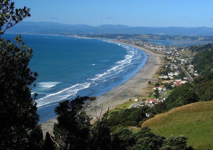 Ohope Beach
Ohope Beach offers the walker, bather, surfie, fisherman 11 kms of uninterrupted, white, Pacific beach sand.
Its north facing aspect gives you the full arc of plentiful sunshine. In excess of 2,250 hrs per year.
For more information on Ohope Beach visit www.ohopebeach.info.
 West End, Ohope Beach
Location: West End Road, Ohope, Whakatane
West End in Ohope is a hidden treasure that many visitors fail to find. Turn left at the bottom of Ohope Hill and be in for a pleasant suprise. Only a kilometre from the main shops there is a large car park, toilets and is home to the West End Board Riders club. From here you can walk over to the pacific jewel of our coast, Otarawairere Bay.
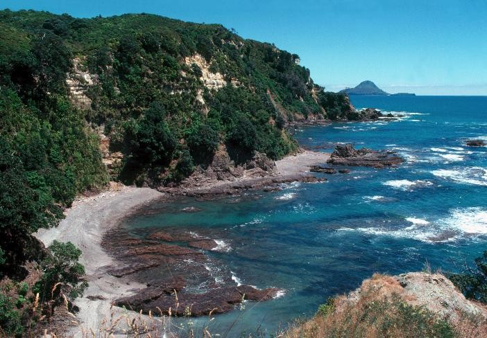 Otarawairere Bay
Otarawairere Bay is located between Whakatane and Ohope and is only accessible by walking from either West End, Ohope or Whakatene. The short walk (which is part of the Kohi Point walkway) over the hill from Ohope will take about 20 minutes and is suitable for any fitness level. However, if you want a longer walk take the Walking Track from Whakatane which will take you about one and a half hours. The beaches at Orarawairere are secluded and feature sheltered waters, rock pools and shells.
Ohope Scenic Reserve - Fairbrother Loop
Location: Pohutukawa Ave, Ohope
The Fairbrother Loop Walk is the first portion of the Ōhope Scenic Reserve. It can be an exciting place to visit during the day or night! It takes one hour if you take the full loop back to Ōhope.
Click here for the Whakatane Kiwi Trust's Fairbrother Loop Self Guided Walk Guide with points of interest such as Kiwi, Morepork and more.
Ohope Harbourside Trail
Location: Waterways Drive, Ohope Beach
The Ohope Harbourside Trail was officially opened on March 24 2018 and is the completion of a long-held dream of making the changing moods and estuarine beauty of the Ōhiwa Harbour more accessible to the community. Rotary Club Whakatane raised over $200,000 for this project. The Trail is 2.9-kilometres of shared-use pathway that runs along the harbour edge, from Waterways Drive in the west to Port Ōhope Wharf.
Click here for more information on Ohope Harbourside Trail.
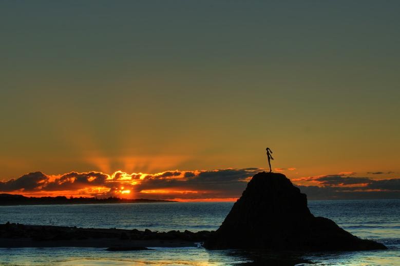 Whakatane Heads
Location: Muriwai Drive, Whakatane
The Whakatane Heads is one of the first landing sites by Maori on their arrival to New Zealand. These days the Whakatane heads is the entrance to the Whakatane river and is poular with local boaties who cross the river bar as they head out to sea. The Whakatane heads has a fantastic surf break when there is a north easterly swell of 2 metres or more. The Whakatane heads is a great picnic area for the family and excellent fishing from the rocks ensures the Whakatane heads is used by many fisherman all year round.
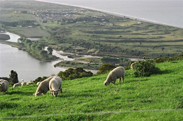
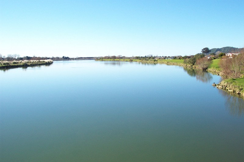 Whakatane River
The Whakatane River rises in the heavily forested Urewera Country some 3 ½ miles west-north-west from Lake Waikaremoana. Adjacent watersheds are Rangitaiki to the west, the Mohaka to the south, and the Wairoa to the south-east. Ruatahuna lies beside the Whakatane River only 6 miles north of its southern watershed, and here the river is crossed by the Rotorua-Waikaremoana main highway in a more or less extensive clearing in the dense forest. The main part of the river lies in the angle of a major fault which is a northern extension of the Wellington fault. The rocks of the catchment are mainly Triassic and Jurassic greywackes, sparsely fossiliferous, with some Tertiary sandstones at Ruatahuna. The Bay of Plenty coastal plain extends as a broad valley some distance up the Whakatane River, but above this the river flows through gorge-like topography. It floods more or less seriously once or twice a year, inundating about 1,000 acres of land. The catchment area is 601 sq. miles, with minimum flows of about 200 cusecs, and flood flows of about 30,000 cusecs. Locals and visitors use the Whakatane river for a number of recreational uses including white baiting, fishing, boating, swimming and waka ama events.
Click here for information on the Whakatane River Walkway / Cycleway.
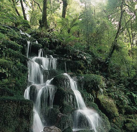
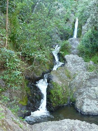 Wairere Waterfall
Location: Toroa Street (access via The Strand), Whakatane
Wairere waterfall was once a prominent landmark, one of three given to Toroa, the leader of the Mataatua waka, by his father Irakewa. Although now largely obscured by the development of the town, the falls remain one of the most beautiful and historically significant sites in Whakatane.
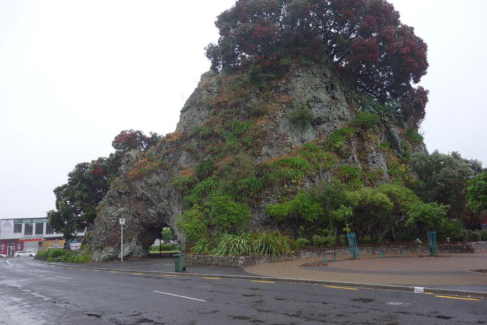 Pohaturoa Rock
Location: The Strand, Whakatane
On this steep-sided sacred rock in the center of the town is a tapu cave in which the Maoris used to hold their ceremonies. Since 1927 it has been a memorial to the dead of the first world war. From the almost vertical summit of the rock there is a fine view of the town - in good weather it is possible to see the plumes of steam on White Island.
"Pohaturoa", the rock sacred to Ngati Awa in the centre of Whakatane CBD, resplendent in Pohutukawa blossom.
 Te Urewera National Park Forest - Lions Hut
Location: 2143 Matahi Valley Rd, Te Urewera National Park. Approximately 1 hour drive from Whakatane.
Te Urewera is a well-used park, particularly by Tuhoe who regard the forest as a 'food basket'. Local hunters hunt for deer and pigs.
Anglers and trampers have a wide range of tracks and huts to choose from.
The Whakatane Lions Club built a 40-bed education hut in 1969. The 'Lions Hut' is available for all to use, and many school parties make it a base for their summer camps.
Schools have been regular visitors since the hut was opened. For more information about bookings etc contact Toni on 308 5624 from 9am - 5pm or visits the website www.lionshut.org.nz
Remote, rugged, immense, Te Urewera National Park contains the largest forested wilderness remaining in the North Island. It is famous for its lakes and forested beauty as well as its stormy history. This 212,672 hectare park lies between the Bay of Plenty and Hawkes Bay in the North Island. It is the largest of the North Island's national parks and the fourth largest in New Zealand. The nearest towns are Whakatane and Taneatua to the north, Murupara and Ruatahuna to the west, and Wairoa to the east. Te Urewera National park includes a variety of short walks and tramps through the Waimana Valley and the Whakatane River which are accessible from the Whakatane boundary of the park. http://www.doc.govt.nz/parks-and-recreation/national-parks/te-urewera
 Lake Rotoma
Location: State Highway 30, Rotoma. Approximately 40 minutes drive from Whakatane.
Formed by the Rotoma eruptions, this eastern-most lake has two distinct basins. The lake has a small outflow through porous pumice substrate to Lake Rotoehu, and has some outflow to groundwater. Lake Rotoma is the cleanest of all the Rotorua Lakes, with around 11 metres depth water clarity and no invasive lake weeds. This is likely to be because only 15% of the catchment is in pasture, and this is not intensively farmed. However the lake has a high risk of lake weed infestation from nearby Lake Rotoehu or other lakes.
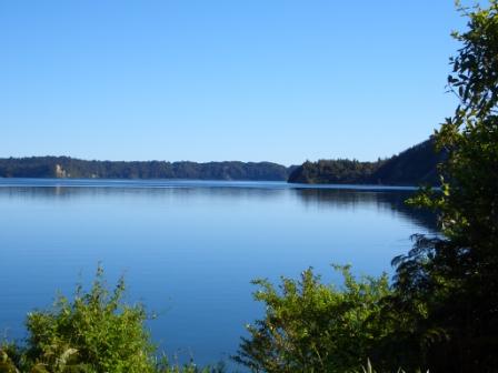
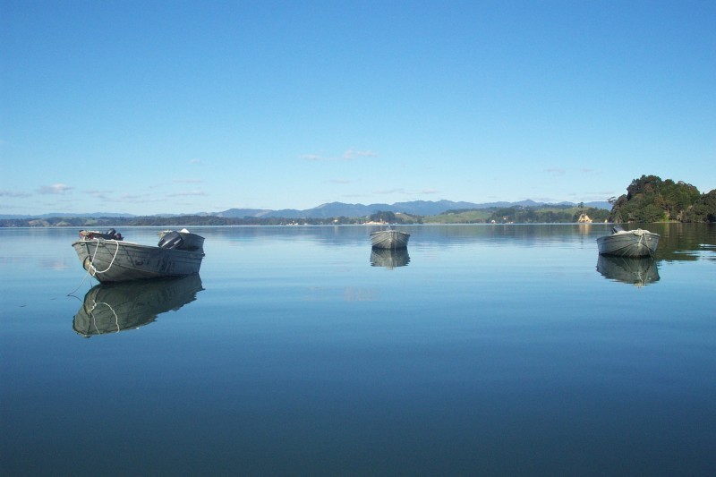 Ohiwa Harbour
Ohiwa Harbour is a stunning place. It’s a natural paradise, an ancestral home, a long-valued food source, and a wonderful outdoor playground. But Ohiwa is also highly vulnerable. We share a special responsibility - to respect and care for this place we love.
Ohiwa is one of New Zealand’s most unspoilt harbours. The coastal margins are home to many rare and migratory birds. The estuary shores have healthy saltmarsh and plant communities. There is high conservation value across islands, foreshore, saltmarsh and wetlands.
For centuries, Ohiwa has been of huge importance to Maori. It is a traditional mahinga mataitai (food gathering place), a taonga, a treasure to be looked after with pride. Because such a special place needs to be cared for, a strategy has been drafted that will help us protect your harbour.
Click here for information on the Port Ohope Wharf including Google Street Views.
Tauwhare Pa - Ohope
Location: Wainui Road, Ohope Beach
Tauwhare Pa is a preserved pre-European Maori occupation site dating from around A.D 1700. This was about the time that most of the pa sites around Ohiwa Harbour where built.
The pa terraces with panoramic views across Ohope and Ohiwa Harbour are easily accessible with a small trek only minutes from the Ohope - Opotiki road (Wainui Road). The parking for the pa site and entrance is just around the corner from Ohope Beach off Wainui Road.
In times of occupation houses and a marae or meeting-house were positioned in the heavily defended top terraces. The lower terraces were used for cooking houses and drying fish. 30 People would have built and lived in this pa probably going elsewhere to fish and garden in some times of the year. From Tauwhare Pa you can see other evidence of Maori Pa sites in the distance.
The site is sacred to the Maori people of the Eastern Bay of Plenty and you are asked to enjoy and respect it.
Click here for more information on Tauwhare Pa including Google Street Views.
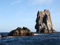 Volkner Rocks Marine Reserve
Te Paepae Aotea ( Volkner Rocks ) consist of three andesitic rock stacks or pinnacles that rise to approximately 113 metres above sea level. The pinnacles are geologically linked to the active andesitic volcano of White Island. Large schools of pelagic and reef fish are found within the boundaries of the marine reserve and some species are locally rare due to the unique convergence of oceanic and subtropical currents at this southern location. This is a also place of great significance to Ngāti Awa and other iwi of the Mātaatua waka. It is the departure place for the spirits of all people from Mātaatua iwi.
Click here to view the Te Paepae o Aotea brochure.
Seafire Dive Attraction
Location: Just off White Island
A 44 meter fishing vessel 'SeaFire' moored over its final resting place in 30 meters of water, just South of Whale Island and about 6 miles out from Whakatane and became New Zealands latest wreck dive.
Whakatane Astronomical Society / Observatory / Planetarium
Location: Hurinui Ave, Whakatane
For an amazing view of the Southern Stars, Moon and Solar System. Get a great view of the southern skies through our 35.50cm celestron and 25.4cm Meade instruments. Click here for more information.
Popular Swimming Spots
Ohope Beach
Ohope Beach, voted NZs most loved beach, is only 6km from Whakatane and offers the walker, bather, surfie or fisherman 11 kms of uninterrupted, white, Pacific beach sand. Ohope Beach has various popular swimming & playing spots including the below.
Mahy Reserve
Location: bottom of the Ohope Hill (Ohope Road), Ohope. Parking is off West End Road and on Pohutukawa Road.
The Surf Life Saving Club is located at Mahy Reserve, Ohope and provides a 'swim between the flags service' in summer with lifeguards patrolling the beach in the summer. Mahy reserve is a great place for picnics, with electric barbecues, tables, playground facilities and parking. There are also a limited number of free overnight campervan parking sites.
Ohope West End
Location: West End Road, Ohope (turn left at the bottom of the Ohope hill)
The West End is a popular swimming spot and is popular with surfers too. There are parking, changing and toilet facilities. You can also access a walking track that takes you over the hill, through the bush to Otarawairere Bay. The walk is steep in some parts.
Otarawairere Bay
This bay is a hidden jem that is is only accessible by walking or by water. There are walking tracks from the Kohi Point walking track and Otarawairere Road, these tracks are suitable for active people. This bay has a sheltered white shelly beach with a bush background. There is safe swimming in the bay, and rock pools at each end of the beach. Take picnic gear and stay for the day, a great family day out.
Maraetotara Reserve
Location: 237 Pohutukawa Ave, Ohope
Here you will find a playground with a flying fox, skatepark and a pirate ship among other activities. Electric barbecues are available and there are toilets. Kids often spend hours playing in the Maraetotara Stream mouth just by the playground.
For more information about Ohope click here.
Wairaka Centennial Park, Playground & Swimming area, also know as "The Heads"
Location: Muriwai Drive, Whakatane
The re-developed Wairaka Centennial Park in Whakatane includes:
- A zero-depth water play area and tidal pool for younger children
- A significant upgrade for the existing playground
- A swimming/diving/jumping area for older children
- Barbecues, picnic tables